Sunday, 1 June 2008
Tuesday, 29 April 2008
Monday, 28 April 2008
Wednesday, 23 April 2008
Tectonic Activity: What you need to know!
The Earth.s crust is unstable and creates hazards:
Global distribution of continental plates. Tensional and compressional margins. The processes of plate movements should be understood and their role in the formation of fold mountains, earthquakes and volcanoes.
Characteristic features and formation of fold mountains, earthquakes (focus, epicentre) and volcanoes (composite and shield volcanoes).
Occurrence and measurement of earthquakes:
The link between earthquakes and plate boundaries to be understood.
The interaction between people and the environments and hazards created by tectonic activity.
Description and explanation of human activity in one range of young fold
mountains. Study of one range of fold mountains e.g. tourism, farming, and HEP in the Alps or Rockies.
Case study of effects and responses to a volcanic eruption and an earthquake to include primary and secondary effects and the short medium and long term responses. Two case studies are required, a volcanic eruption e.g. Montserrat and an earthquake eg. Kobe. Study to include the short, medium and long term responses of different interest groups e.g. local and national government, aid agencies etc.
Settlement issues in areas of tectonic activity . the advantages and disadvantages of settlement in areas of tectonic activity. Students should appreciate that areas affected by tectonic activity present both advantages and disadvantages for settlement e.g. the threat of a volcanic eruption versus the fertile soils for farming as on the slopes of Mount Etna or the threat of avalanches and difficulty of communications versus the valuable minerals able to be mined in the Andes mountains.
Variations in the effects of and responses to tectonic activity between rural and urban areas, and between MEDCs and LEDCs. A consideration of the values and attitudes of different interest groups. Choice of earlier case studies from both an MEDC and LEDC will make it easier for students to appreciate these variations. Consideration may be given to differences in population densities, building materials, availability of emergency services, quality of communication networks, relative wealth etc. Values and attitudes to tectonic activity may include the unwillingness of some people to accept the hazard or the need to use the fertile soils through to those who would advise abandonment of areas prone to tectonic activity.
There are a significant number of earlier posts on the management of tectonic activities. Use the spec. to 'traffic light' your knowledge & understanding. Remember that the questions can highlight VERY specific areas of the spec. e.g. shield volcanoes!
Sunday, 13 April 2008
Lets get back to basics! Skills needed here.....
There are several areas of skills outlined in the spec. that may be specifically tested on Paper 1. They are:
- Basic Skills
Labelling and annotation of diagrams, maps, graphs, sketches etc.
Drawing sketches from photographs and in the field.
Photographs: candidates should be able to use and interpret aerial/oblique and satellite photographs of rural and/or urban landscapes. - Cartographic (map) Skills
Atlas maps: recognising and describing distributions and patterns of both human and physical features.
Sketch maps: draw, label, understand and interpret sketch maps. - Ordnance survey maps: 1:25 000 or 1:50 000 scale, recognise symbols, four and six figure grid references, straight line and winding distances; direction, draw and annotate cross-sections, height and degree of slope, simple contour patterns, patterns of vegetation and land use; patterns of communications; location, shape and pattern of settlement; different land use zones of settlements; infer human activity from map evidence; using maps in association with photographs
- Graphical Skills (In coursework AND in the exam)
Construct line, bar, scattergraphs and pie diagrams.
Complete a variety of graphs and maps including choropleth, isoline and proportional symbols.
Interpret a variety of graphs including those located on maps and topological diagrams.
*Additional enquiry and ICT skills are outlined in the specification but are covered principally in learning activities and in the coursework specifically.
We will spend the first couple of lessons of the revision programme practicing these skills. The subject specific material will be drawn from a full range of topics to give you a feel for what specific topics you need to give most attention to.
We will start with the big picture, drawing them to be precise. There are a number of excellent websites that remind you how to draw a 'fieldsketch'. It is unlikely that you will have to draw one from scratch in the exam but you may well be asked to annotate one (label it IN DETAIL).
This website is a great place to start as it also covers River Landforms & Flooding, plus Tourism.
Monday, 17 March 2008
Coastal Management
The specification mentions the following:
Coastal management issues – coastal erosion and tourism. The social, environmental and
political problems caused by coastal erosion and tourism e.g. cliff collapse, coastal flooding, problems of resorts. It states that students should be aware of small scale exemplars of coastal areas where management issues occur. Such examples may include the Holderness coast (erosion), a Spanish resort and Bangladesh (coastal flooding). This includes the problems caused and their impact on different groups such as locals, governments and visitors.
You also need to know about the strategies used to solve problems such as coastal defences e.g. groynes, sea walls, extending the tourist season and providing new facilities. The different values and attitudes of interested groups to coastal protection strategies and tourist developments and which strategies constitute sustainable development.
Cause & Effect of Coastal Erosion

Follow this link to produce a stunning summary diagram of the cause & effect of coastal erosion.
Play (yes play!) the match up waves game to test your understanding of the work you did last lesson.
This website gives a good overview of the understanding that you need for the physical geography aspect of the coasts topic.
Tuesday, 11 March 2008
Start 'Coasts' (without me)
This is the first part of the specification:
 Constructive and destructive waves. Processes of erosion (hydraulic power, corrosion, corrasion; attrition; transport (traction, saltation, suspension, solution, longshore drift) and deposition. Landforms and characteristic features and formation of wave cut platforms, cliffs, caves, arches,
stacks, beaches, spits in the context of an example of an erosional coastline and a depositional coastline.
MOST of this should be familier from work in Year 8
Use your text book to complete notes on Constructive & Destructive Waves & the processes of erosion. Use text book and/or http://www.s-cool.co.uk/ and/or this website. Record your notes into your exercise books. Include diagrams!!!!
HOMEWORK: Listen to the podcast on this site if you haven't been able to do so in class. Do podcasts help you learn? Could you record your own? Great for audio/kinesthetic learners.
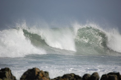
I took this photo last summer in the Scottish Hebrides!
Monday, 10 March 2008
First student video!
This is an awesome video Dom! See me tommorow - I think a Headteachers stamp is inorder, don't be content with publication on the worldwide web! There are a couple of 'tippos' but they don't detract from the video. This is a great way to revise! (This has taken an hour to download onto blogger!)
Sunday, 24 February 2008
Using SAMLEARNING
Education Leeds subscribes to 'SAMLEARNING' as Boston Spa Students are aware. The material for GCSE Geography is very sound & even if you have a high target grade you will benefit from reviewing & revising topics using SAMLEARNING. Your homework for this session is to complete the two assigned tasks on Urbanisation in MEDC & LEDC countries. Go to www.samlearning.com & log-in. Your teaching group (11E) has tasks assigned to it. It will count towards your SAMLEARNING challenge hours BUT it is NOT optional!
Tuesday, 19 February 2008
Wednesday, 6 February 2008
Tuesday, 5 February 2008
Sunday, 27 January 2008
The last leg........ unless we decide to cover 'coasts' too!

The last section of the specification that we HAVE to cover is settlement.
It includes:
Site . dry and wet point, aspect, shelter, defence, resources and communications. Many siting factors important in the past are now no longer important due to technological change. Settlements with a favourable site especially in respect of communications e.g. gap towns, route
centres and bridging points often grew into trading centres.
Size . the hierarchy of settlement linked to population size, services and sphere of influence.
Function . types of settlements and how their function may change over time.
Urban morphology models of an MEDC and LEDC city , contrast in morphology. This includes detailed study of one MEDC & one LEDC city. We will mainly study LEEDS & Rio de Janairo.
Urban morphology models of an MEDC and LEDC city , contrast in morphology. This includes detailed study of one MEDC & one LEDC city. We will mainly study LEEDS & Rio de Janairo.
 The characteristics of the urban zones . the CBD, inner city, suburbs and rural urban fringe in the MEDC and the CBD, high class sector, shanty towns in the LEDC.
Definition and causes of urbanisation.
The different pattern of urbanisation in MEDCs and LEDCs.
 What factors have infuenced the SITE and SITUATION of Boston Spa?
The problems of urbanisation.
Social, economic, environmental issues in the CBD and inner city in MEDCs and in the shanty towns in LEDCs.
Contemporary solutions to problems of the CBD and inner cities in MEDCs and to shanty towns in LEDCs to achieve sustainable development.
Tasks
Site and SituationWhen we talk about the site of a settlement, we are refering to the land on which the hamlet, village, town or city is built. A number of site factors would have been important when choosing the inital site of a settlement. These would have included the relief of the land; the availability of natural resources; water supply and the fertility of the surrounding land.We also talk about the situation of a settlement, this is the location of a place relative to its surroundings (which may include other settlements, landscape features such as rivers, uplands etc.)
What factors have infuenced the SITE and SITUATION of Boston Spa?Start with factors that affect the site & situation of settlements. The S Cool Revision site is really good for this (or use the text books). You need notes on the factors that determine the site & situation of a settlement. DO NOT JUST PRINT OUT from S-Cool! Then answer the question about Boston Spa. Complete this plus homework task before the next lesson.
Homework: Watch this! Its a production by BBC schools in Northern Ireland & its examples are from Northern Ireland but it will provide an excellent review of the introduction to the topic.
Sunday, 20 January 2008


Monday, 14 January 2008
Paper 1
Skills, Rivers, Glaciation, Plate Tectonics! All of the details for these sections are now outlined on the blog. There are a number of posts about the physical aspects of Rivers & Glaciation, but less on the human aspects of these topics. All aspects of earthquakes & volcanoes are covered BUT not fold mountains.
Rivers: What do you need to know?
Long and cross profiles, processes of erosion (hydraulic power, corrosion, corrasion, attrition), transport (traction, saltation, suspension, solution) and deposition.
The characteristics and formation of waterfalls, gorges, meanders, ox-bow lakes, levees, flood plains and deltas.
River basin management issues – the causes and effects of flooding in river basins in the context of both LEDCs and MEDCs. Mississippi and Bangladesh.
The short, medium and long term strategies used to attempt to manage the floods.
Contemporary issues concerning use of ‘hard’ v ‘soft’ strategies and attempts to
achieve sustainability.
The social, economic, environmental and political issues that have an impact upon
strategies and the values and attitudes of interested groups.
Look at Geography Room (A level blog) for notes/ powerpoints on the two river basin management case studies.
Tuesday, 8 January 2008
How to Revise!
I have 'booted' this post up. There are plenty of subject specific posts in the blog. I will highlight some of the key ones.
Exams looming? No need to panic, just get organised! Find somewhere quiet to work, somewhere that you feel comfortable. Take frequent breaks, work in short bursts. Every 30 minutes or so, change topic or subject. When you're revising, the trick is to be active. That means not simply reading your books and hoping that it'll sink in, but actually doing something with the information. But what should I actually do?You may find some of these links useful! Think carefully about the questions that are asked - How will you manage your time? Where is the best place to revise? What do you need to revise? What are the different techniques that can be used for revision? How can I concentrate when I am revising? The first link is to the Aston University student support site. Don't be put off by this - the issues are the same for University Students. The second link is to 'Know it all' which is a site that I mentioned for the trial exams.What are the stages of revising a topic?Stage 1 - get your material together. Make sure you have all the course handouts and copies of all the key readings, and that you know where the notes you took during the course are Stage 2 - get a feel for the course. Read over the handouts and your own notes Stage 3 - look at previous exam papers (see Student information) Stage 4 - select your topics for revision (see above) Stage 5 - the solid work Remember what type of learner you are & work to your strengths.Use different techniquesMake it stick -go over stuffLook ,cover, write, checkFill diagrams in from memoryUse highlightersMake 'expert cards'Make jigsaws -separate terms & meanings then match them upPractice exam questionsUse online revision siteslisten to podcasts (eg on Biitesize), record your ownTeach a topic to someone elsePost other techniques that work as a comment to this blog!Visit this (and other) Geog Blogs..... Often!
Exams looming? No need to panic, just get organised! Find somewhere quiet to work, somewhere that you feel comfortable. Take frequent breaks, work in short bursts. Every 30 minutes or so, change topic or subject. When you're revising, the trick is to be active. That means not simply reading your books and hoping that it'll sink in, but actually doing something with the information. But what should I actually do?You may find some of these links useful! Think carefully about the questions that are asked - How will you manage your time? Where is the best place to revise? What do you need to revise? What are the different techniques that can be used for revision? How can I concentrate when I am revising? The first link is to the Aston University student support site. Don't be put off by this - the issues are the same for University Students. The second link is to 'Know it all' which is a site that I mentioned for the trial exams.What are the stages of revising a topic?Stage 1 - get your material together. Make sure you have all the course handouts and copies of all the key readings, and that you know where the notes you took during the course are Stage 2 - get a feel for the course. Read over the handouts and your own notes Stage 3 - look at previous exam papers (see Student information) Stage 4 - select your topics for revision (see above) Stage 5 - the solid work Remember what type of learner you are & work to your strengths.Use different techniquesMake it stick -go over stuffLook ,cover, write, checkFill diagrams in from memoryUse highlightersMake 'expert cards'Make jigsaws -separate terms & meanings then match them upPractice exam questionsUse online revision siteslisten to podcasts (eg on Biitesize), record your ownTeach a topic to someone elsePost other techniques that work as a comment to this blog!Visit this (and other) Geog Blogs..... Often!
Subscribe to:
Posts (Atom)
Must have a map!
